Every fishing trip I take starts with a map, a cup of coffee, and a little imagination. Whether I’m launching my kayak into the quiet marshes of Galveston Bay or loading up my fly rod for a week chasing trout in the mountains of southwest Colorado, I treat every trip like its own adventure.
Over time, I’ve built a system that helps me find the right water, prepare for changing conditions, and capture moments along the way through fishing photography. It’s a mix of digital scouting, tide and river flow research, fly fishing strategy, and a lot of intuition.
Here’s how I plan my trips—from coastal redfish missions to high-country fly fishing—along with the tools, tactics, and gear that help me get the most out of every cast.
Step One: Finding the Right Water
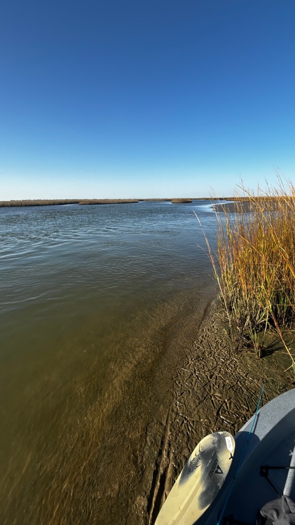
When I’m planning a coastal trip around Galveston, I start with Google Earth fishing maps. I zoom in on marsh drains, shell reefs, and grass flats, marking potential ambush points where redfish and speckled trout might be waiting for bait to push through with the tide.
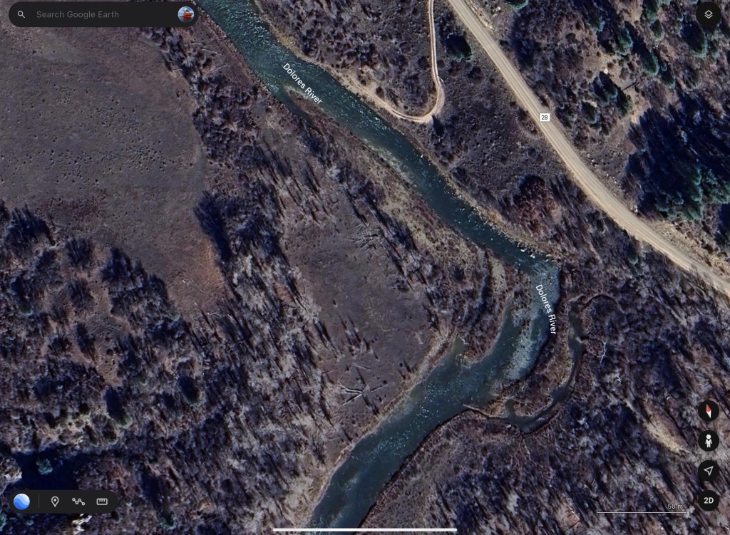
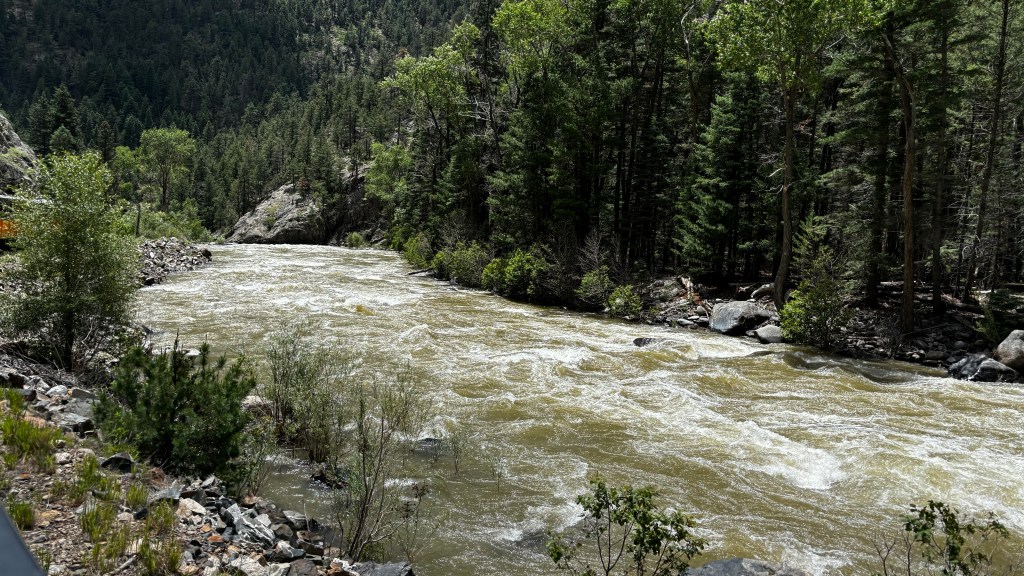
For trout fishing trips, I turn to the TroutRoutes app, especially when heading into places like the Dolores River, Pine River, Animas River, or Florida River in Colorado. TroutRoutes shows me public access points, fly fishing regulations, and real-time stream flows—all in one spot. It’s hands-down one of my favorite apps for planning fly fishing trips in Colorado.

I also pull up local fly shop reports and check in with forums and social groups. A few minutes of reading recent trip reports can save me hours on the water later.
Timing is Everything: Tides, River Flows & Weather
Fishing success is all about timing and conditions.
On the coast, I build my trips around tide charts, solunar tables, and wind forecasts. I want to be on the water as the tide’s moving—either pulling bait into the marsh or draining it out through cuts and creeks. That moving water gets everything active, especially when paired with stable pressure and clean water.
For my Colorado trips, I pay close attention to USGS stream gauges. If flows are too high from runoff or summer storms, I might switch to a smaller tributary or hit a tailwater like the lower Dolores. Watching water temperature is equally important—trout get lethargic in warmer water, especially in late summer.
“Success often comes down to 15 minutes of movement—when the tide shifts or the hatch explodes.”
My Fishing Strategies: Flats to Freestones
Inshore Fishing: Texas Marsh Tactics
When I’m chasing redfish on the flats, I’m looking for signs of life—nervous bait, shrimp jumping, birds diving, or the golden back of a redfish pushing through grass. I love fishing with paddle tails, especially the JVS Custom Baits Rip Rap in Copper Penny or a 3.5” Speed Shrimp when fish are keyed in on crustaceans.
If I’m fly fishing in the marsh, I keep it simple: crab and shrimp patterns, long leaders, and a quiet approach. Sight casting to tailing reds never gets old.
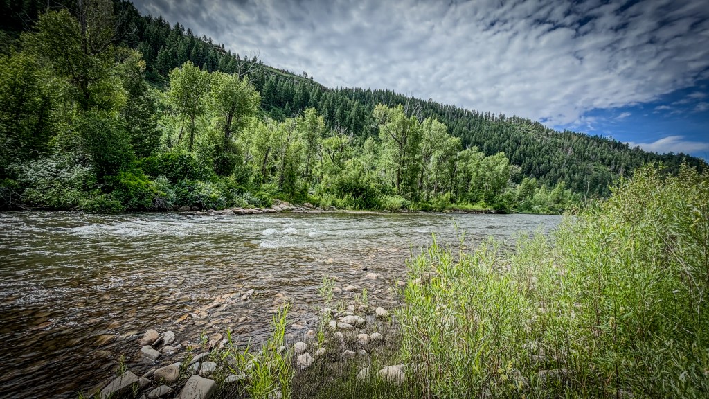
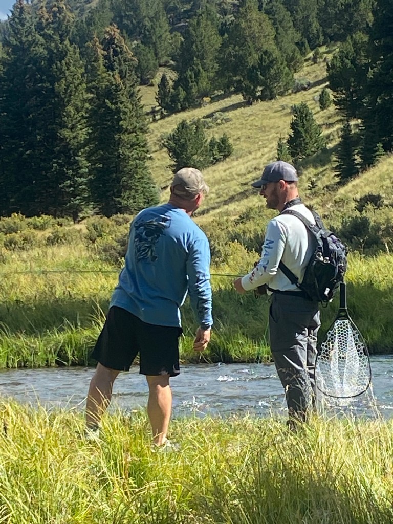
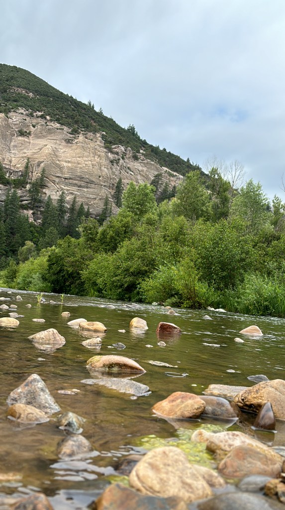
Mountain Fly Fishing: Reading Water & Matching the Hatch
In Colorado, fishing rivers like the Pine or Animas means constantly adjusting to what the water gives me. One bend might call for dry flies in pocket water, the next might demand nymphs under an indicator in a deep, slow pool.
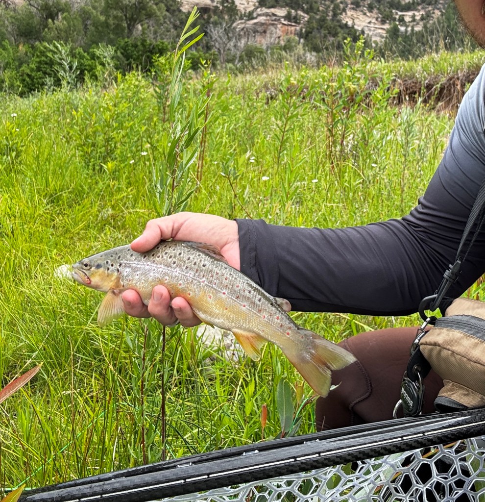
When the hatch is on—especially during a caddis or stonefly emergence—I’m in heaven. There’s something about watching a trout rise in fast water, especially when I’ve hiked in for miles with just a small pack and a fly box in my pocket.
Safety First: Especially in the Backcountry
Whether I’m kayaking a remote bay system or hiking into the upper Florida River, I take safety seriously.
• I carry offline maps and GPS, especially when I’m deep in the mountains or out of cell range in a bay system.
• I use a Personal Locator Beacon (PLB) for emergencies—peace of mind goes a long way.
• In mountain country, I pack layers for changing weather, a water filter, and bear spray when needed.
Knowing how to read the weather—and knowing when to pull the plug—has saved me more than once.
Capturing the Experience: Fishing Photography in the Field
Fishing is about more than just catching fish. For me, it’s also about the quiet moments between casts—the mist rising off a river at dawn, a redfish tail breaking the surface, or a trout slipping back into cold, clear water.
That’s where photography comes in. I bring my Canon R5, along with a few key lenses: a Canon L-series for landscape shots, and a Sigma for tighter portraits of fish and wildlife.
I use:
• A K&F Concept tripod for stability when shooting long exposures
• Polarizing filters to cut glare and bring out the detail in water shots
• A dry bag and padded camera insert to protect my gear in the kayak or backpack
Some of my favorite moments are captured during the golden hour—sunset glowing off a canyon wall in the Animas, or first light over the saltgrass back home in Galveston.
Final Thoughts: Why I Plan Fishing Trips This Way
I fish for the thrill of the catch—but also for the quiet, the challenge, and the story. The time I spend planning my trips—researching tides, scouting rivers, organizing gear—is all part of the journey.
Fishing the Dolores River one day and stalking redfish on the Texas coast the next keeps me connected to the water in totally different ways. Both require patience, curiosity, and a little humility.
If you’re planning your own trip—whether it’s chasing tailing redfish or hiking into a hidden trout stream—take your time. Look at maps. Check the flows. Watch the weather. Bring a camera. And most importantly, enjoy the ride.
Tight lines and clear skies—see you out there.
